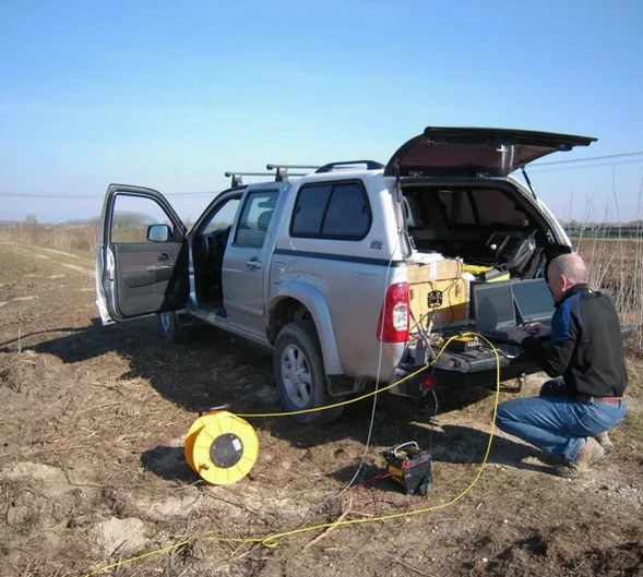
IBC Chapter 16 and ASCE 7-22 require site-specific shear wave velocity data when Site Class determination from SPT alone is insufficient. In Arlington, the interbedded limestone, marl, and shale of the Cretaceous Eagle Ford and Woodbine Formations produce sharp velocity contrasts that standard MASW surveys can miss. Seismic refraction and reflection tomography map these interfaces with precision—critical where karstic voids and solution cavities in the Austin Chalk correlate directly to differential settlement risk. The 32.7°N latitude and hot summers demand attention to trigger timing and geophone coupling in dry clays. We deploy 48-channel seismographs with vertical and horizontal geophones, processing first breaks and reflection hyperbolae through iterative tomographic inversion to deliver 2D velocity cross-sections calibrated against SPT drilling logs and local borehole data.
Seismic velocity in weathered Austin Chalk can drop from 2,800 m/s to 850 m/s within a 3-meter vertical window—miss that transition and you miss the settlement mechanism.
Quick answers
How much does a seismic refraction tomography survey cost in Arlington?
A typical 2D refraction line of 115–230 linear feet with 24–48 geophones runs between US$2,450 and US$4,870, depending on spread length, source type (sledgehammer vs. accelerated weight drop), and whether both P and S-wave acquisition are required. The cost includes field crew, equipment, tomographic processing, and a signed report with velocity sections.
What depth can seismic refraction reach in North Texas limestone?
With a 230-foot spread and an accelerated weight drop source, we routinely image to 50–60 feet in competent Austin Chalk. Penetration drops in dry, highly weathered chalk where attenuation is high; adding reflection processing of the same record extends usable depth by 20–30% without additional field time.
Can seismic tomography detect voids or cavities in Arlington's karstic limestone?
Yes—air-filled voids produce a sharp velocity drop surrounded by a diffraction pattern visible on raw shot gathers. Tomographic inversion resolves the low-velocity anomaly, but confirmation requires a borehole or test pit intersecting the feature. We flag anomalies and recommend targeted verification drilling.