In Arlington, the subtle topography of the Grand Prairie region often conceals challenging slope conditions: expansive Eagle Ford Shale at shallow depth, interbedded limestone, and stiff overconsolidated clays that lose strength fast when wet. We have reviewed cut slopes along I-20 widening projects and residential developments in the Viridian area where a 3H:1V slope looked adequate on paper but started creeping after a wet spring. That practical experience shapes every slope stability analysis we perform. Because a desk study without site-specific shear strength parameters is just a guess, we combine rotary drilling for undisturbed Shelby tube sampling with SPT drilling to characterize the weathered zone and define the groundwater table, then run consolidated-undrained triaxial tests on the shale to get real effective stress parameters before touching any limit-equilibrium model. The approach is direct, backed by ASTM D1586 and D4767, and delivered in plain engineering language without marketing fluff.
A slope that looks stable in dry August can fail in wet February: Arlington's seasonal moisture cycles demand a drained and undrained analysis, always.
Methodology and scope
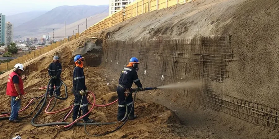
A recent project near Lake Arlington required analyzing a 28-foot-high fill embankment supporting a new commercial pad. The developer had preliminary plans showing vertical MSE walls, but our subsurface investigation revealed a 6-foot-thick lens of fat clay with PI above 40 and residual friction angles below 12 degrees. That changes everything. We modeled the cross-section in a two-dimensional finite-element platform, assigning Mohr-Coulomb parameters calibrated to the triaxial data, then iterated through drained and undrained scenarios following FHWA-NHI-05-123 guidelines. The analysis showed that the global factor of safety dropped to 0.98 under rapid drawdown of the adjacent pond, which triggered a redesign with a flatter bench and a toe drain. When the slope geometry is constrained by right-of-way limits, we often integrate
stone columns through the weak clay layer as a ground improvement measure before placing fill, which increases the composite shear strength enough to meet the IBC-required minimum FoS of 1.5 for permanent slopes. We also run pseudostatic analyses using the Arlington-design horizontal acceleration from the USGS hazard maps, because the Balcones Fault Zone is still active and site-specific seismic coefficients matter. The deliverables include detailed soil stratigraphy, pore pressure distribution, critical slip surfaces from Spencer's method, and construction-phase monitoring recommendations, all signed by a Texas-licensed professional engineer.
Local geotechnical context
Arlington's climate is the hidden variable in slope stability: long hot summers desiccate the upper 8 to 10 feet of Eagle Ford Shale, opening hairline tension cracks that become preferential infiltration paths when autumn rains return. We have measured pore pressure spikes of 15 to 20 feet of hydraulic head within 48 hours of a 3-inch storm, enough to erase the apparent cohesion and trigger shallow translational slides in cut slopes that had been standing for years. The risk is compounded in older neighborhoods near Fish Creek and Rush Creek, where natural drainage channels cut into overconsolidated clays with relic slickensides aligned parallel to the slope face. A triaxial test program on undisturbed samples from those zones typically reveals strain-softening behavior with post-peak strength reductions of 40 to 60 percent, which means a slope can fail progressively rather than all at once, giving little visible warning. We account for this by using fully softened shear strength envelopes in our long-term stability models, per the empirical correlations developed by Stark and Eid for Texas high-plasticity clays, and by specifying detailed surface drainage control measures in every slope design report.
Quick answers
What is the cost of a slope stability analysis for a single-family home lot in Arlington?
For a residential lot with a single cut or fill slope under 12 feet high, the analysis typically falls between US$1,110 and US$3,570, depending on whether we need new soil borings and lab testing or can work with existing geotechnical data. The fee covers the limit-equilibrium modeling, the signed engineering report, and one round of design recommendations. If ground improvement or a retaining structure is required, the scope, and therefore the cost, increases accordingly.
How deep do you investigate the soil for a slope analysis in the Arlington area?
We drill or excavate to a depth of at least twice the slope height or until we reach competent bedrock, whichever is shallower. In the Eagle Ford Shale terrain typical of Arlington, that often means 20 to 30 feet for a 15-foot cut slope, with continuous SPT sampling through the weathered zone and Shelby tube recovery in the intact shale below. The objective is to define the groundwater table and capture any low-strength seams that could control the failure surface.
Do you include seismic slope stability checks for Arlington, even though it is not a high-seismicity zone?
Yes, we include a pseudostatic analysis using the site-specific horizontal acceleration from the USGS 2023 National Seismic Hazard Model. For Arlington, the mapped PGA with a 2 percent probability of exceedance in 50 years ranges around 0.08g to 0.12g on rock, and we apply a kh of roughly half that value per FHWA guidance. The check often governs for temporary construction slopes and for permanent slopes with marginal static factors of safety below 1.3.