← Home · Underground Excavations

Geotechnical Excavation Monitoring in Arlington, TX

Together, we solve the challenges of tomorrow.

LEARN MORE →

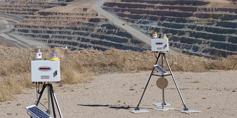
A total station with automated tracking sits on a concrete pillar near the Cowboys' practice facility in Arlington, taking readings every 15 minutes on a 32-foot-deep excavation. The crew installing the soldier pile wall doesn't even notice it anymore—it just runs. What the instrument is catching are movements of maybe a tenth of an inch in the adjacent pavement, shifts that wouldn't register on a tape measure but that tell us exactly how the Eagle Ford shale is responding to dewatering. That's the reality of excavation monitoring in this part of North Texas: the soils move slowly, then suddenly. We set up arrays of inclinometers, crack gauges, and automated prisms because the difference between a stable cut and a sloughing failure in fat clay is often just a few hours of missed data. For deep digs near Abrams Street or along I-30, tying the monitoring plan into the slope stability analysis is standard—and skipping it is how you end up with a street closure you didn't budget for.

In Arlington's Eagle Ford shale, a tenth-inch movement caught at midnight saves a street closure by noon.

Methodology and scope

IBC 2021 Section 3304 and OSHA Subpart P lay out the legal floor, but Arlington's geology demands more. The upper 15 to 20 feet are stiff, overconsolidated clays with joints and fissures that open up as soon as you relieve lateral stress; below that, the shale can be surprisingly competent until it gets wet, at which point it slakes into a slick paste. Our monitoring plans start with a baseline survey—vibration readings on neighboring structures, inclinometer casings grouted into the shale behind the wall, and piezometers to track pore pressure decay—then run continuously through backfill. When the excavation crosses the static water table (often perched in weathered shale fractures), we correlate settlement data with in-situ permeability test results so the dewatering rate matches what the formation can handle without pulling fines. Every instrument gets a defined alarm threshold tied to actual structural tolerances, not some generic number from a manual.
Geotechnical Excavation Monitoring in Arlington, TX
Technical reference image — Arlington

Local geotechnical context

We have walked onto sites in Arlington where the contractor had taken manual readings with a tape and level for two weeks and thought everything was fine—until a crack opened up across the parking lot over a weekend. The error is always the same: measuring only at the top of the wall and assuming the soil mass is moving as a block. In fissured clay, the failure surface can daylight 30 feet behind the wall face while the soldier beams haven't budged a millimeter. Our approach pairs deep inclinometers (grouted into rock below the theoretical failure plane) with surface settlement arrays far enough back to catch the tension zone. If you are excavating next to an occupied building—say a retail center on Cooper Street—we also run crack monitors on the structure itself, because tenant complaints about drywall cracks will cost you more in delays than the entire monitoring budget.

Need a geotechnical assessment?

Reply within 24h.

Email: contact@geotechnical-engineering.xyz

Typical values

ParameterTypical value
Monitoring frequency (active excavation)2-4 readings/hour on automated stations
Inclinometer casing depth5-10 ft below excavation subgrade
Settlement point accuracy±0.03 inches (digital level)
Vibration monitoring threshold0.5 in/s PPV per Arlington building code
Typical alarm trigger (lateral)0.5 inches cumulative or 0.25 in/day rate
Piezometer typeVibrating wire, automated data logger
Reporting intervalDaily summary + real-time alert for exceedances

Complementary services

01

Automated Total Station Arrays

Robotic stations with 24/7 data logging on prisms mounted to retaining walls, adjacent building facades, and pavement points. We set alarm thresholds at 70% of allowable movement so the superintendent gets a call before it becomes a problem.

02

Inclinometer & Piezometer Networks

Grouted-in-place inclinometer casing paired with vibrating wire piezometers at multiple depths. This combination tells you not just how much the ground is moving, but why—pore pressure decay is the leading indicator of stability loss in Arlington shale.

03

Crack & Vibration Monitoring

Triaxial geophones for blasting or compaction vibration, plus tell-tale crack gauges on any structure within a 1:1 influence line from the excavation toe. All data streams feed into a single dashboard the project team can access from a phone.

04

Settlement & Heave Surveys

Deep benchmarks installed outside the zone of influence, with settlement plates and heave points tracked by digital level. We run baseline surveys before the first shovel hits dirt and compare every reading to the pre-construction condition.

Relevant standards

IBC 2021 Chapter 33 (Safeguards During Construction), OSHA 29 CFR 1926 Subpart P (Excavations), ASTM D6230-13 (Monitoring Well Installation), ASTM D4403-12 (Extensometers in Rock), FHWA GEC No. 4 (Ground Anchors and Anchored Systems)

Quick answers

How much does excavation monitoring cost for a typical Arlington commercial project?

For a standard commercial excavation—say a 20-foot-deep cut with soldier pile walls adjacent to a parking lot—monitoring plans run between US$960 and US$2,390 per month depending on the number of instruments and reporting frequency. Automated systems with real-time alerts are at the higher end; manual reading programs with weekly reports sit at the lower end. The cost is driven by instrument count, not by project size: a small excavation next to a sensitive structure can cost more to monitor than a big open-cut site with nothing nearby.

What triggers an alarm in your monitoring system?

We set two-tier alarms: a warning threshold (typically 70% of the design allowable movement) and an action threshold (90%). For lateral movement in Arlington clay, warnings usually fire at 0.35 inches cumulative or a rate exceeding 0.15 inches per day. The action threshold—which calls for stopping work and inspecting the excavation—depends on the wall type and adjacent structure tolerances, but 0.5 inches total or 0.25 inches in a 24-hour period is a common benchmark for soldier pile and lagging systems.

Do I need monitoring if my excavation is less than 20 feet deep?

Depth alone does not determine risk. A 14-foot cut next to an existing building on Abrams Street can be far more hazardous than a 30-foot cut in an open field. IBC requires protective systems for excavations deeper than 5 feet, and OSHA mandates a competent person inspection daily. Monitoring with instruments becomes essential when you are within the zone of influence of structures, utilities, or roadways—regardless of depth. In Arlington's expansive clays, even a shallow cut can cause enough lateral strain to crack pavement 40 feet away.

How long does monitoring continue after backfill?

We typically maintain instrumentation for two to four weeks after final backfill, or until movement rates drop below 0.05 inches per week for two consecutive readings. In some cases—particularly where adjacent structures showed pre-existing cracks—we recommend a post-construction survey at 90 days to document that conditions have stabilized. The monitoring plan submitted with the permit will specify the duration, and Arlington building officials generally want to see data through the most critical phase, which is the first major rain event after compaction.

Location and service area

We serve projects across Arlington and surrounding areas.

View larger map