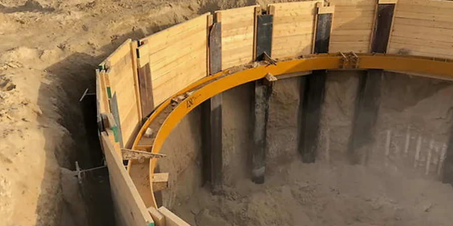
One of the most expensive mistakes we see in Arlington is specifying shallow foundations where deep piles are unavoidable. The Eagle Ford Shale is deceptive—stiff at the surface, but highly weathered and expansive less than 12 feet down across much of Tarrant County. When a contractor skips the geotechnical exploration and pours a mat slab on grade, differential movement appears within two seasons of drought and rain cycles. We run the SPT drilling program first, because N-values from the shale layers tell us immediately whether the skin friction will develop or whether the shaft resistance will degrade under moisture fluctuation. Our pile foundation design workflow starts with that log—without it, you are guessing about the bearing stratum and the active zone depth, and guesswork drives pile costs up fast when the rebar cage has to be extended mid-project.
Skin friction in weathered Eagle Ford Shale can drop 40 percent after prolonged saturation—our design locks in the residual strength, not the peak.
Methodology and scope
The Cretaceous-age Eagle Ford Group underlies most of Arlington, but the upper 10 to 20 feet are typically a weathered, fractured shale that transitions into a more competent limestone-shale interbed. Water table depth varies from 8 to 18 feet depending on proximity to the Trinity River floodplain and Lake Arlington, and perched groundwater in the weathered zone is common after heavy spring rains. Our pile foundation design accounts for this layered profile by correlating SPT blow counts with undrained shear strength measured in the triaxial cell, so that both end bearing and shaft friction are calibrated to site-specific soil behavior rather than textbook defaults. For sites near Joe Pool Lake or along Village Creek where soft alluvial clays overlie the shale, we often run a CPTu sounding to resolve thin sand lenses that can act as drainage paths and alter the pore pressure regime around the pile shaft during driving. The design output includes axial capacity curves for driven H-piles and drilled shafts, buckling checks where the pile extends above grade in high-water-table conditions, and group efficiency reductions when spacing drops below three diameters. Settlement estimates come from t-z curves built on the lab consolidation data, not from empirical correlations that were developed for Gulf Coast clays and do not transfer well to the stiff, preconsolidated Arlington shale.
Local geotechnical context
The risk profile changes sharply between the Lamar Boulevard corridor and the newer subdivisions west of Green Oaks Boulevard near the lake. Along Lamar, fill thickness often exceeds 6 feet—old construction debris, clay lumps, and undocumented utility trenches that create negative skin friction on piles when the fill consolidates over time. West of Green Oaks, the natural shale is close to the surface, but the slope toward the lake introduces a lateral component: global stability of the pile group must be checked under the drained condition when the lake level drops rapidly in summer. A common failure mode in Arlington is pile head deflection in expansive clay where the upper 8 feet of shaft were not sleeved, allowing the swelling soil to lift the pile cap at the edge of the building. Our pile foundation design specifies a minimum isolation casing depth of 10 feet in the central Arlington corridor, verified against the soil plasticity index from the Atterberg suite, because PI values above 30 in the weathered shale demand a longer unbonded zone to protect the structure from seasonal heave.
Quick answers
How deep do piles typically go in Arlington before reaching competent bearing?
In the central Arlington area, the weathered shale gives way to competent limestone-shale interbed between 18 and 30 feet below grade. Near the Trinity River and Lake Arlington, where Holocene alluvium overlies the bedrock, piles may extend to 45 or 50 feet. We confirm refusal depth with SPT refusal (N > 50 for 6 inches) or by coring into the unweathered rock to verify it is not a floating boulder layer.
What is the approximate cost range for pile foundation design in Arlington?
A complete pile foundation design package—including the SPT drilling program, laboratory testing for strength and consolidation, axial and lateral capacity calculations, and the signed design report—typically falls between US$1.910 and US$6.110 depending on the number of borings, the pile load test scope, and whether lateral analysis for seismic or wind governs. We provide a fixed-fee proposal after reviewing the structural loads and the site plan.
Does the design account for the expansive clay problem common in North Texas?
Yes. We measure the plasticity index and the swell potential on remolded samples from the upper 15 feet of each boring. Where the PI exceeds 30 and the swell pressure exceeds 2 ksf, the design includes an isolation casing or a void form beneath the grade beam to decouple the pile cap from the active zone. The unbonded length is sized so that the swelling soil cannot transmit uplift to the pile head.
How do you verify the design during pile installation?
We use PDA (Pile Driving Analyzer) dynamic testing on at least two production piles per cluster to confirm that the driving stress and the transferred energy match the wave equation analysis. For drilled shafts, we run cross-hole sonic logging (CSL) in the concrete to check shaft integrity. If the field data show a capacity shortfall, we recalculate the group efficiency and adjust the pile count before the contractor leaves the site.