Together, we solve the challenges of tomorrow.
LEARN MORE →Geotechnical investigation in Arlington forms the critical foundation for safe and durable construction across the county's varied landscape. This category encompasses the systematic assessment of subsurface soil, rock, and groundwater conditions to inform foundation design, earthwork, and infrastructure development. Given Arlington's dense urban environment and proximity to the Potomac River, thorough investigation is not merely a best practice—it is an essential risk management tool that protects investments and public safety. The process typically integrates field exploration, laboratory testing, and engineering analysis to characterize site-specific constraints and opportunities.
Arlington's geology presents unique challenges that demand specialized investigation techniques. The county straddles the Fall Line, the transitional boundary between the hard crystalline bedrock of the Piedmont Plateau to the west and the softer, unconsolidated sediments of the Atlantic Coastal Plain to the east. This geological juxtaposition means subsurface conditions can vary dramatically over short distances. Investigators frequently encounter decomposed schist and gneiss, marine clay lenses, and variable groundwater tables influenced by tidal fluctuations near the river. Understanding these local conditions is paramount for predicting settlement, assessing slope stability, and designing effective dewatering systems for below-grade construction.
All geotechnical investigations in Arlington must comply with the Virginia Uniform Statewide Building Code (USBC), which adopts and amends the International Building Code (IBC). Chapter 18 of the IBC mandates soil investigations for any structure requiring a foundation, with specific requirements for seismic site class determination and expansive soil evaluation. Arlington County's Department of Environmental Services enforces these provisions strictly, requiring reports stamped by a licensed Professional Engineer. Additionally, projects disturbing more than 2,500 square feet must adhere to the Virginia Erosion and Sediment Control Law, integrating geotechnical data into stormwater management and grading plans.
This category of services is indispensable for a wide spectrum of projects shaping Arlington's built environment. High-rise commercial developments in Rosslyn and Crystal City rely on deep borings and in-situ testing like the CPT (Cone Penetration Test) to design deep foundations and earth retention systems. Mid-rise residential buildings along the Rosslyn-Ballston corridor require precise bearing capacity and settlement analyses. Infrastructure projects, such as the county's ongoing stormwater management upgrades, depend on permeability testing and soil characterization. Even single-family home additions in neighborhoods like Lyon Village often trigger the need for a foundational investigation to ensure structural integrity on marginal soils.
A geotechnical investigation is mandatory under the Virginia USBC for any structure requiring a building permit. Arlington County typically requires a report for new commercial, multifamily, and institutional buildings, as well as retaining walls over four feet high. Residential additions may also trigger the requirement if they impose new loads on unknown soils or are located in areas with mapped geologic hazards or high shrink-swell potential.
The most significant factor is the proximity to the Fall Line, creating a transition from hard Piedmont bedrock to softer Coastal Plain sediments. Decomposed rock, expansive marine clays, and a shallow, fluctuating water table near the Potomac River are common. These conditions can lead to differential settlement, challenges with rock excavation for basements, and the need for robust waterproofing and underdrain systems.
Boring depth is not standard but is determined by the proposed structure's load and footprint. The IBC requires borings to extend through all unsuitable strata and to a depth where the stress increase from the foundation is less than 10% of the existing soil stress. In Arlington's high-rise districts, this often means extending borings 60 to 100 feet or more to competent bedrock, while low-rise structures on Coastal Plain sediments may require depths of 30 to 50 feet.
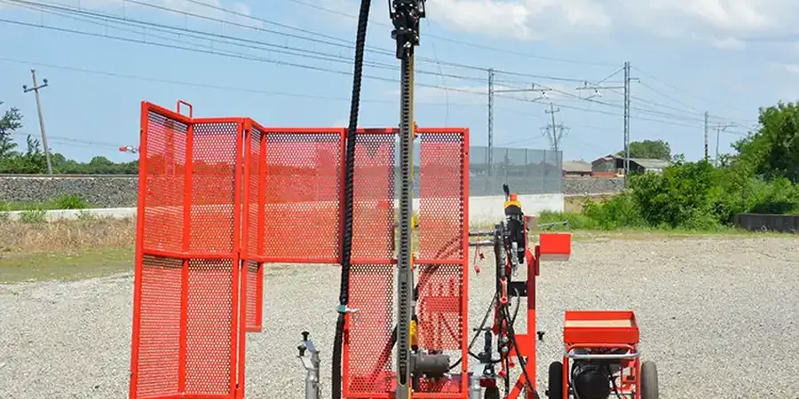
A standard boring involves drilling a hole, retrieving disturbed and undisturbed samples, and performing a Standard Penetration Test (SPT) at intervals. A Cone Penetration Test (CPT) is an in-situ method that pushes an instrumented cone into the ground continuously, providing high-resolution data on soil type, strength, and stratigraphy without generating cuttings. The CPT is often faster and provides a continuous profile, making it ideal for characterizing soft soils and detecting thin layers, while borings are necessary for direct sampling of harder materials.